Trusted by sailors since 1978 – available in print & eBook
The original and most comprehensive guide for sailors and motor boaters to the coasts of Norway, Svalbard and Jan Mayen.
Expert insight gathered in over 50 years of cruising Norwegian waters.
Why this Guide
For almost fifty years, the Norwegian Cruising Guide has accompanied sailors along the length of Norway’s remarkable coastline. First published in 1978, at a time when reliable English-language information was scarce, it quickly became the standard reference for those venturing north. Since then, it has been expanded, revised and carefully handed on from one group of committed cruisers to the next.
A Tradition of Continuity
What makes this Guide distinctive is not only its scope, but its continuity. Each generation has built directly on the work of those before them — not rewriting from scratch, but refining, correcting and expanding based on firsthand experience. The result is a body of knowledge accumulated over decades at sea: harbours revisited, anchorages rechecked, passages sailed again in different conditions and seasons. That long memory gives the Guide a depth that cannot be assembled quickly.
A Guide that Evolved
From its early focus on parts of the coast, it grew in the 1990s to include North Norway, Svalbard and Jan Mayen, eventually covering the entire route from the Swedish border to the Russian frontier and into the high Arctic. In 2006, it was among the first major cruising guides to appear as an interactive eBook, opening new possibilities for linked navigation and digital planning. Each development has had the same purpose: to make the Guide more useful to those actually sailing these waters.
Beyond Harbour Entrances
We have always believed that the best cruising guides do more than describe how to enter a harbour. They help you decide where you want to go, and why. Norway is not a coastline to be rushed through. It is a place of vast landscapes, small communities, deep fjords and open horizons. To cruise here well is to engage with more than charts and waypoints.
Practical Detail, Deeper Insight
For that reason, this Guide combines practical harbour and anchorage information with cultural, historical and geographic context. Where appropriate, you will find suggestions for walks ashore, notes on local history, and observations that help you understand the character of a place. The aim is not to overwhelm, but to enrich — to give you enough perspective to turn a safe landfall into a meaningful stop.
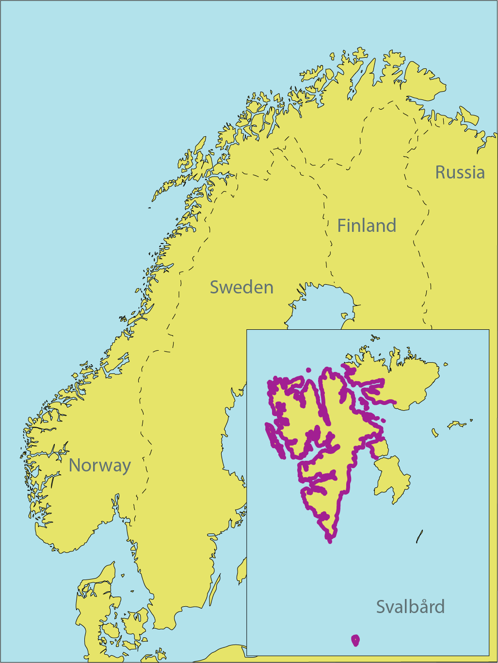
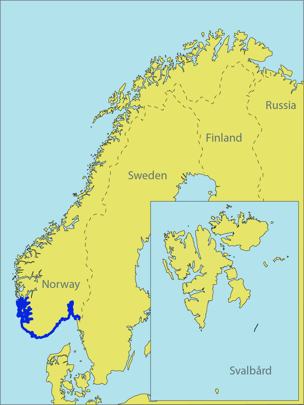
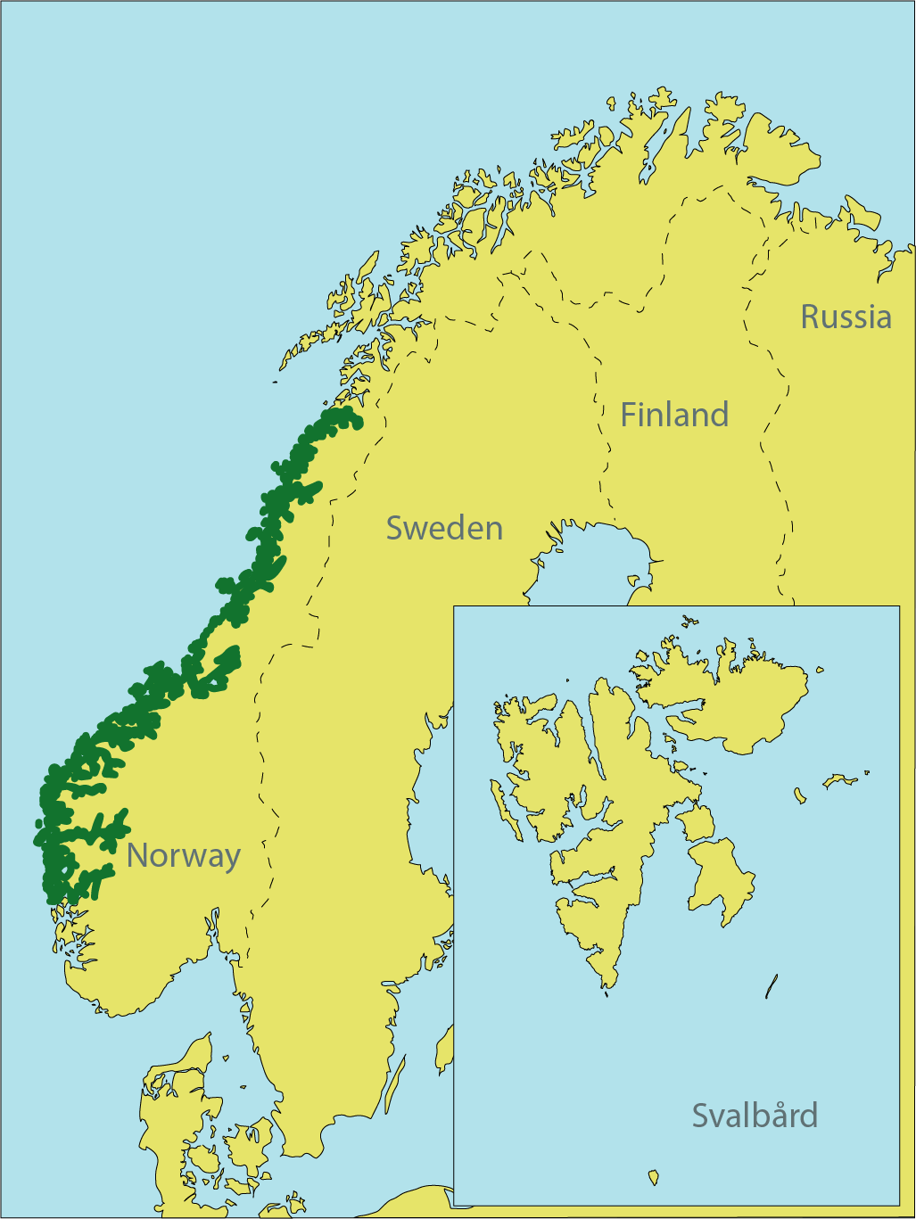
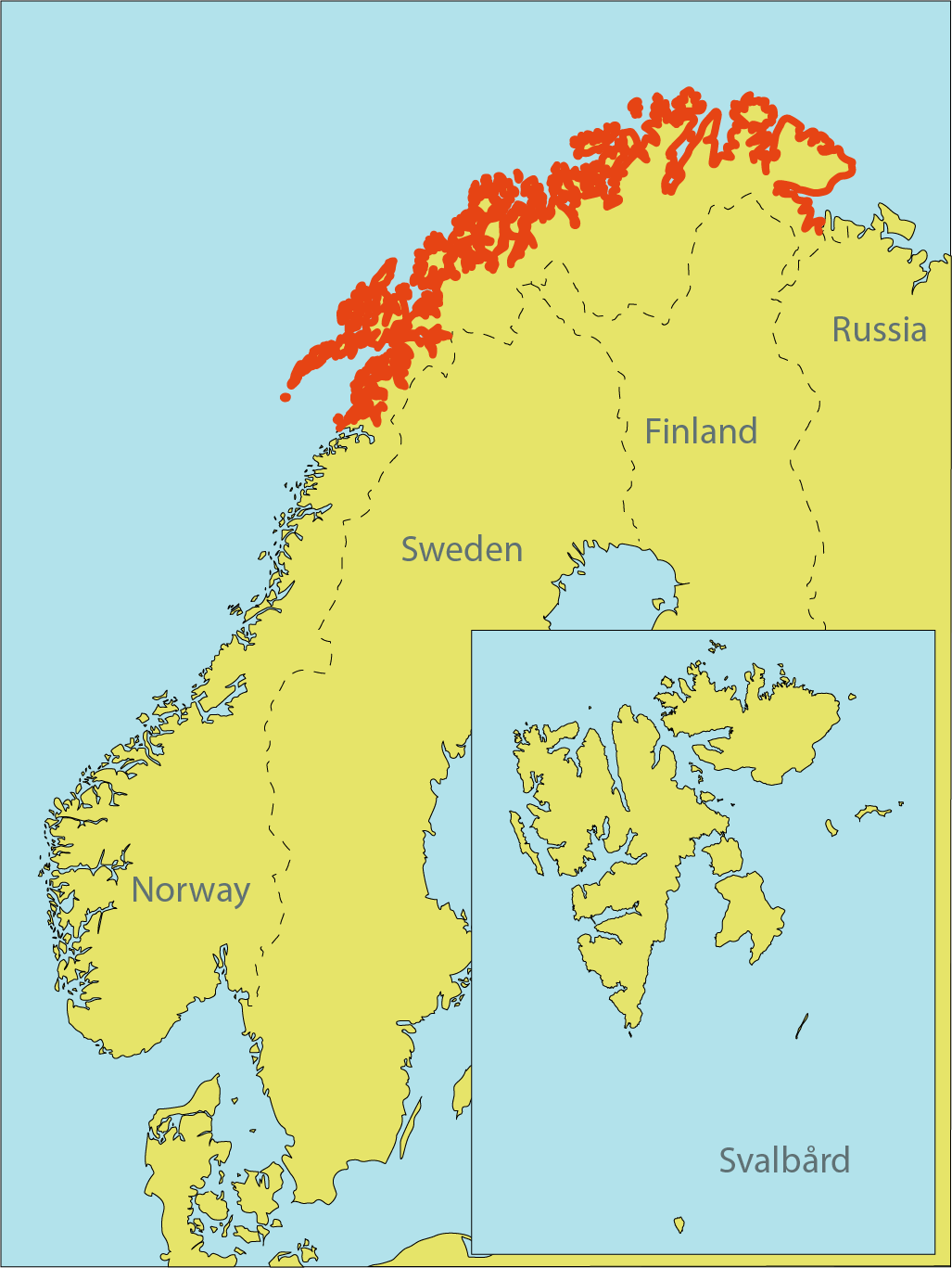
Complete Coastline Coverage
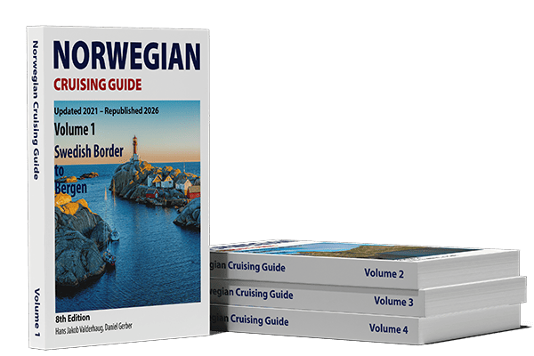
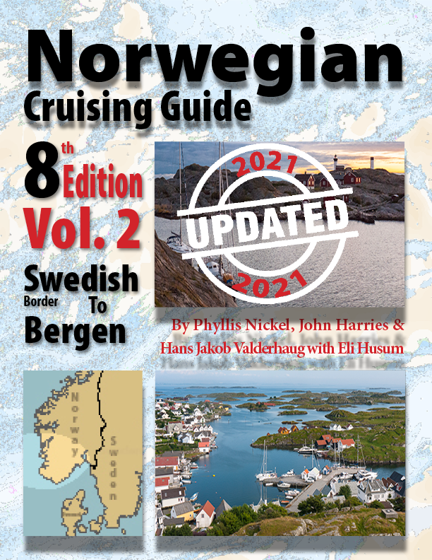
Volume 1: From the Swedish Border up to and including Bergen
Volume 2: From Bergen up to and including Bodø
Volume 3: From Bodø to the Russian Border, including Lofoten and Vesterålen
Volume 4: Bjørnøya, Svalbard and Jan Mayen
Together, they cover one of the longest and most varied cruising grounds in the world.
Trusted Sources
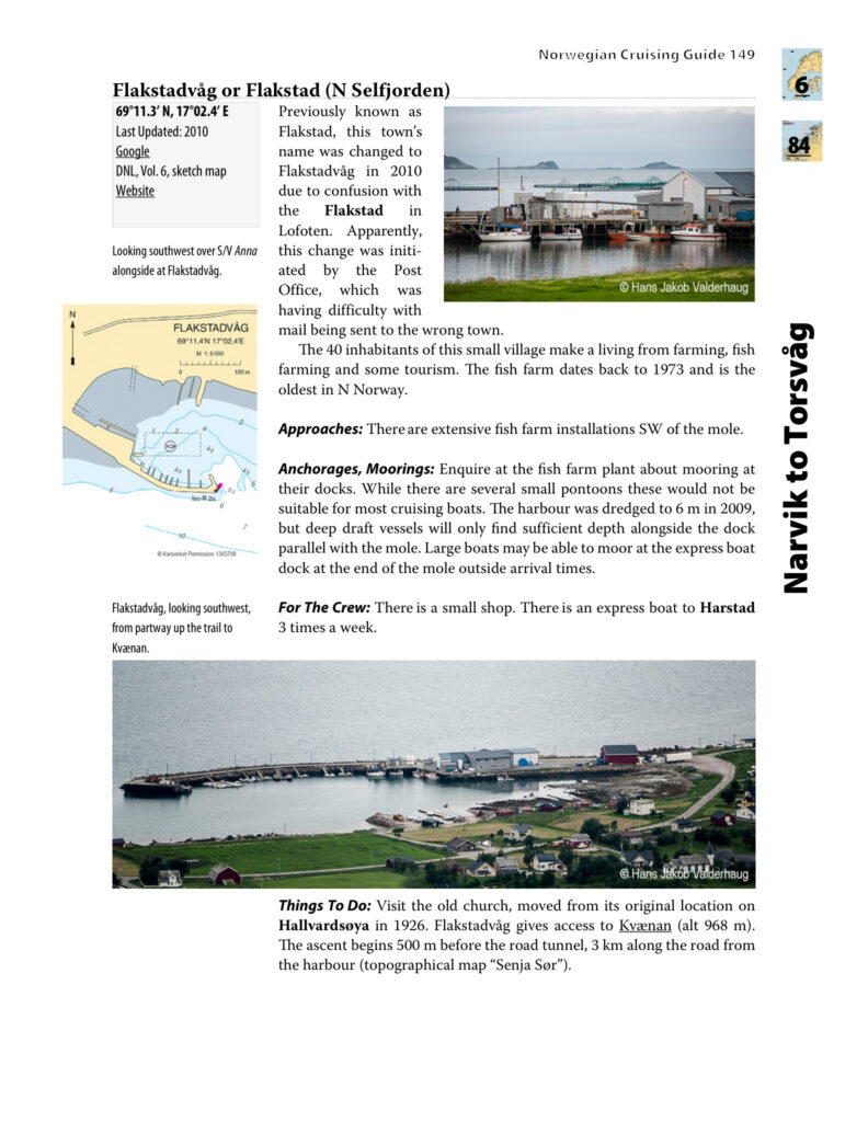
Every harbour and anchorage entry follows a consistent structure. Coordinates are provided in WGS 84 format. The date of last visit or update is stated clearly. Information boxes allow you to scan quickly for essentials. Official naming conventions are respected, and references align with Norwegian cartography and Den Norske Los.
Designed to Complement Your Charts
Chapter maps orient you before you depart. Favourite harbours and key landfalls are clearly marked. Coastal Danger Areas are shown with permission from the Norwegian authorities. Sketch maps from official sources are included where available, and additional diagrams are provided when clarity requires it. Throughout, we assume that you are navigating with proper charts; this Guide is designed to sit beside them, not replace them.
Clarity in Design
Layout and typography are practical rather than decorative. Line lengths are chosen for readability in print. Screen versions avoid awkward multi-column formats. Margins leave room for your own notes — because every cruise adds something personal to any reference book.
Print Books on Amazon and in Book Stores
The paper editions are produced using print-on-demand technology. This allows us to keep specialist volumes available and to incorporate updates more frequently than traditional print runs would permit. Many sailors still prefer a physical book at the chart table, and we are committed to providing that option.
Interactive eBooks on Apple Books and Google Play Stores
The interactive eBooks extend the Guide further. Thousands of internal links allow rapid movement between regions and entries. Live links connect directly to external resources, including mapping tools and local information. Photographs appear in full colour and resolution. For passage planning and research, the digital format offers clear advantages.
Free General Cruising Information
A comprehensive General Cruising Information section is maintained on this website and it is updated whenever relevant changes come to light. This ensures that essential background knowledge remains current.
Built on Firsthand Experience
Most of the material in this Guide has been gathered directly by sailors who have cruised these waters themselves. Over the years, many others have contributed observations, corrections and updates. The Guide reflects that collective experience. It has been shaped not in an office alone, but in cockpits, anchorages and harbours along the coast.
Continuing a Trusted Legacy
We are conscious of the responsibility that comes with continuing this work. Those who developed the Guide before us set a high standard of accuracy and care. Our aim is to maintain that standard — and, where possible, strengthen it — so that it remains worthy of the trust sailors place in it.
Preparation Is Essential
Norway rewards preparation. Distances are long. Weather systems are powerful. Harbours range from well-serviced towns to remote anchorages far from assistance. The better informed you are, the more confident and enjoyable your cruise will be.
Half a Century of Cruising Knowledge
The Norwegian Cruising Guide exists to support that preparation. It brings together nearly half a century of accumulated knowledge, structured clearly and presented with practical intent. It is designed to help you plan thoughtfully, navigate safely, and experience Norway’s coast in depth.
A Companion for the Journey
For anyone intending to cruise these waters with care and curiosity, this Guide is not simply useful — it is a companion shaped by those who have gone before you, and intended to accompany you along the way.

Essential Information For Cruising in Norway
Explore FREE latest information and advice for panning your cruise to Norway, Svalbard and Jan Mayen.
Waypoints & Coastal Danger Areas
Download FREE waypoints for 1 000+ harbours and anchorages and Coastal Danger Areas for your tablet or plotter.

View a genuine sample chapter of the print book before you buy.

See how the interactive eBook works on a tablet and on a computer.
What’s Inside
Expertise


How to Buy
1. Choose your cruising area
2. Choose your format
3. Choose your store
Recommended Bookstores
EU countries: Vrolijk
Rest of the world: Bookharbour
Amazon
Worldwide delivery, eligible for Amazon Prime
eBooks
Apple Books and Google Books
Buy from Bookstores

Buy Print Edition on

Get eBook on
Get eBook on
Buy from Bookstores
Buy Print Edition on
Get eBook on
Get eBook on
Buy from Bookstores
Buy Print Edition on
Get eBook on
Get eBook on
Buy from Bookstores
Buy Print Edition on
Get eBook on
Get eBook on