The information below is in addition to that presented in the Norway Navigation chapter; some of which also applies to Svalbard.
Charts and Publications
Paper Charts
Svalbard is constantly being re-surveyed and charts are being revised and newly published. In later years there has been a focus on waters near retreating glaciers. However, parts of many charts are still based on old surveys, so beware! Kartverket states that caution should be exercised in water depths less than 50 m and that areas with water depths less than 3 m will not be re-surveyed. Since most paper charts are 1:100,000 and electronic charts are based on these, Kartverket warns against “over-zooming”.
Datum Errors
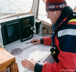
All charts printed after 1992 are WGS-84 datum and can be used with your GPS without adjustment. Charts based on older datums will have longitude values that are inaccurate, making it dangerous to rely solely on GPS positions.
Electronic Charts
If you are bound for Moffen Island, Hinlopenstretet or Nordaustlandet, make sure your charts cover this area, as some electronic charting companies only have coverage up to 80°N. If this is the case, you will need to get paper charts to cover the gap.
Topographic Maps

Svalbard has been extensively mapped topographically at 1:100,000 and at 1:10,000 in a few areas. These maps may be useful for venturing ashore and are also useful for navigating in the relatively uncharted waters of Nordaustlandet, Barentsøya and Edgeøya, even though they have no soundings.
The Norsk Polarinstitutt sells printed copies online. You may also be able to purchase them in one of the shops in Longyearbyen.
You can also view the topo maps of Svalbard online, and we have provided a link to these online maps for each Svalbard harbour/anchorage entry.
Sailing Directions
A list of sketch maps for Svalbard produced by Den Norske Los (no longer being updated as of 2018)
We highly recommend the very fine Arctic sailing directions and visitors’ guide, Den Norske Los, Vol. 7, for both its detailed pilotage and its extensive general coverage of history, climate, ice, flora and fauna, geology and weather.
Vol. 7 is published in both Norwegian and English. It is now only available online as a PDF, and is not integrated into Kartverket online charting as the DNL volumes for mainland Norway are.
This volume has not been updated since 2018
Tides and Tidal Streams
Tidal streams around Svalbard are generally moderate except to the east of Spitsbergen, but when added to currents, the net speed can sometimes reach two knots even in open water.
The standard port used when describing tides is Longyearbyen but, as far as we know, the only tidal gauge for the island group is in Ny Ålesund.
Compasses
As you progress north along the west coast of Spitsbergen, a magnetic compass will probably become more and more sluggish, perhaps even useless around 78°N. Fluxgate compasses may be affected less. Autopilot compasses may also be affected, producing sluggish or erratic performance, particularly on northerly courses.

